Interchange of the Week
Monday, 12 January 2004
Monday, 12 January 2004
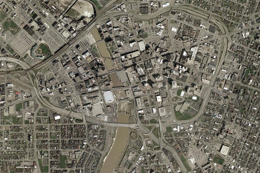
Inner Loop, Rochester: Part 2
 |
|
|
|
|
|
|
Continuing from last week, clockwise along reference route 940T, the Inner Loop crosses the Genesee River at the point where Brown's Race branches away just above the High Falls. Note from the photograph that the Inner Loop bridge is a single structure, while the adjacent CSX railroad crosses the millrace on a separate span.
The next interchange serves, from left to right, St. Paul Street, North Clinton Avenue and Joseph Avenue. The freeway descends into a vertical-walled trench at this point, with service roads running above at street level. The eastbound exit ramp diverges exactly at the eastern bridge abutment, a few hundred feet from the State Street entrance ramp. Immediately, the exit meets North Water Street, which, like Front Street, is a block-long remnant of its former significance. Both streets once extended south to Main Street, through the present site of Genesee Crossroads Park. And there was once a South Water Street where the Rochester Riverside Convention Center stands today.
Once again, the service roads take the name of a former local street, in this case Cumberland Street. And, to a lesser degree than Allen Street, Cumberland shows a small vestige of its former self in a short stub running east from North Water Street to Carthage Alley.
St. Paul Street is crossed first, at the point where it becomes one-way southbound; its northbound lane is fed by Bittner Street. Just to the east, Joseph Avenue splits from northbound-only North Clinton Avenue. North of the Inner Loop, both streets become two-way. A ramp now rejoins the loop, marking the end of eastbound Cumberland Street.
By contrast, westbound Cumberland Street begins farther to the east, at North Street (see below). It is joined by the westbound exit ramp as it passes the former main Post Office, now a neighborhood branch. Cumberland crosses the three main streets, as well as Westcott Street, almost an alley. Central Avenue also meets the intersection of St. Paul and Cumberland Streets, where the statue of Frederick Douglass now located in Highland Park once stood. Notice the various channels at this intersection: entrances to Central Avenue from St. Paul Street and from Cumberland Street, a right turn channel from Cumberland Street to St. Paul Street, and a right turn only from Central Avenue onto St. Paul Street.
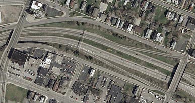
The Scio Street interchange (left) is a westward-pointing half
diamond, located between Lyndhurst Street on the north and Delevan
Street on the south. At left is North Street, where westbound
Cumberland Street begins (more precisely, it begins at the curve in
Lyndhurst Street, which is actually straight).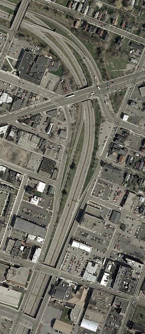
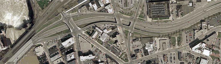
East of Scio Street (pronounced "SIGH-oh"), the Inner Loop curves into a north-south orientation, and signage reflects this. South of East Main Street, it runs between two one-way streets: Pitkin Street (southbound) and North Union Street (northbound). All of these streets, along with University Avenue, come together at the East Main Street interchange (right).
This interchange is a three-ramp partial diamond, with the southbound entrance ramp missing. However, the southbound (or eastbound) offramp, a relatively recent addition, crosses over the northbound roadway so as to form a single intersection with East Main Street and University Avenue. The latter street was cut by the Inner Loop and realigned, thereby erasing most of Anderson Park (a small triangle remains, but the name is forgotten).
The southbound entrance ramp in the right photo is part of the East
Avenue/Broad Street interchange. These two streets cross the Inner Loop
at bottom (and between them a utility conduit). To the south, the Inner
Loop rises to street level, where a set of slip ramps forms an interior
diamond with Pitkin and South Union Streets. The southern pair of ramps
forms the rest of the East Avenue/Broad Street interchange, which, like
the East Main Street interchange, is functionally a three-ramp partial
diamond, this time missing the northbound entrance ramp. The southbound
entrance ramp is peculiar in that it feeds
directly into the right lane of the Inner Loop; there is no
acceleration lane.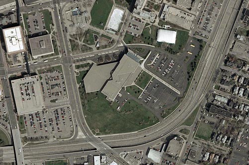
The last clockwise interchange on the Inner Loop is the Monroe Avenue/Chestnut Street interchange. Monroe Avenue ends at the Inner Loop overpass, continuing northbward as Chestnut Street. The NY 31 designation follows these streets, but turns westward onto Woodbury Boulevard one block north of the loop. The eastern half of this interchange, which is essentially a full diamond, comprises the northern pair of slip ramps mentioned above. From there, the southbound service road continues to be Pitkin Street, which was extended southward with the building of the loop (it follows the old alignment of Jordan Alley). Three lanes wide as it crosses Chestnut Street, Pitkin is joined by two lanes from southbound Chestnut Street, and shortly afterward all traffic merges into a single lane which joins the Inner Loop.
The eastbound exit ramp is Howell Street. Intersected by Broadway on
its
south side, Howell Street then crosses Monroe Avenue, curving part way
around before ending at South Union Street. At this point are a few
vestigial streets from earlier days, before an entire neighborhood was
razed to make way for the Inner Loop and the Strong Museum. At bottom left,
we finally
rejoin our starting point, the interchange between the Inner Loop,
Interstate 490, and NY 15, which is discussed in Week
20.