US 20 Travelogue
(click any image to enlarge)
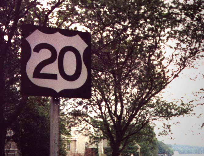
As it winds down its mighty transcontinental journey, US 20 modestly traverses the back country of New York, touching only one major city, Albany. Through Chautauqua and Erie Counties it keeps its distance from Lake Erie, ceding that honor to NY 5, from which it is separated by the Thruway and two railroads. Here the Chautauqua County grape belt, made famous by one Dr. Welch, occupies the narrow plain along the lake shore at the base of the Allegheny Plateau.
US 20, in a series of angles, swings around what were once the outermost limits of suburban Buffalo. It passes shopping centers and a football stadium, then merges onto the Transit Road, following the line of the North Star, before turning due east at Depew.
The landscape becomes decidedly Midwestern here as the road bolts arrow-straight across the boundary between the southern hills and the Lake Ontario lowlands, bending only here and there to descend a gully or climb a ridge. A true 1920's-era superhighway, it intersects the more major cross highways by means of two-lane connector "ramps". It runs through places with names as banal as Town Line and as exotic as Suicide Corners and Texaco Town.
|
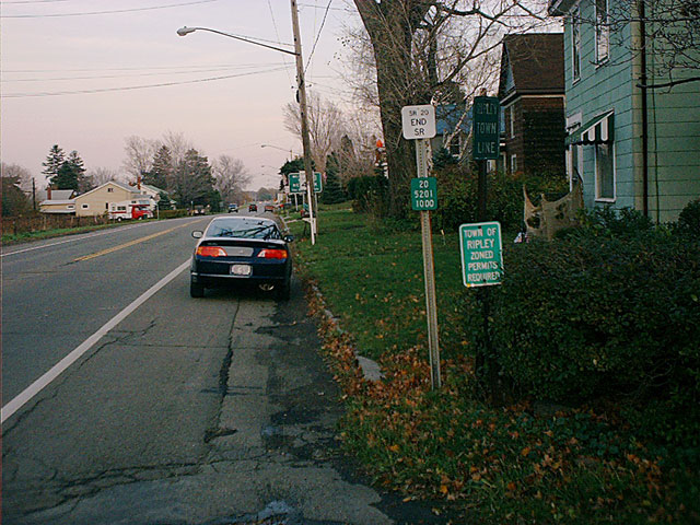
These signs denote the Pennsylvania/New York state line. Visible are Town of Ripley signs and reference markers from both States. The New York welcome sign is in the background. |
|
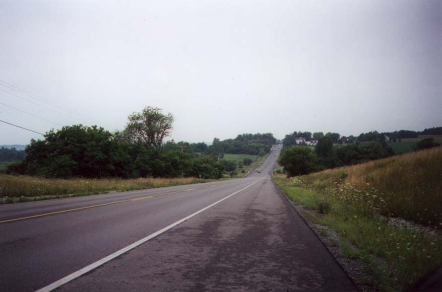
US 20 just east of Centerfield, making a beeline across rolling Finger Lakes farmland. Centerfield is a tiny hamlet not far west of Canandaigua. |
|
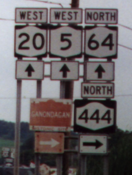
On this assembly at Bloomfield (formerly Holcomb), the wrong shield is used for US 20. Also note the unique sign used for New York's historic attractions, and the odd-looking shield used for NY 444. |
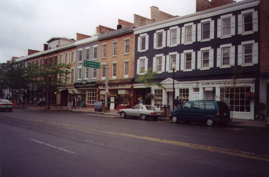
At Canawaugus, southeast of Caledonia, US 20 runs into NY 5, which it overlaps all the way to Auburn. On this stretch the land, never more than gently rolling, is taken up by dairy farms only barely encroached upon by modern subdivision housing. The towns, all northern gateways to the Finger Lakes region, increase in size from Avon and Lima to Canandaigua and Geneva (the latter with its sisters Waterloo and Seneca Falls), and finally the once-prosperous regional marketplace and manufacturing center, Auburn. Canandaigua is bypassed on a comparatively modern four-lane divided highway; Geneva is cut through by a somewhat older arterial. For the first time since Lima, the route runs through the actual village centers of Waterloo and Seneca Falls, twin cities of the Cayuga & Seneca Canal and early centers of the Women's Rights movement.
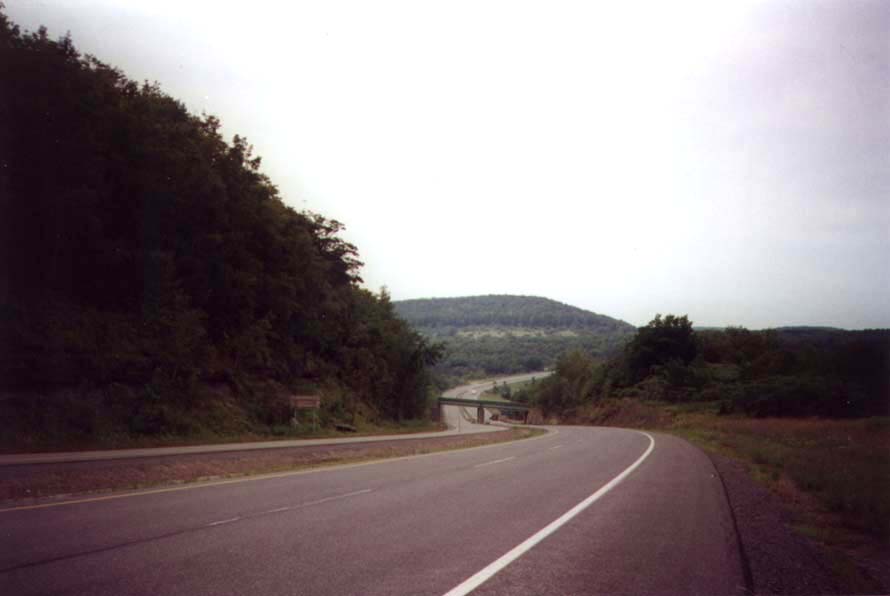
At Auburn, NY 5 leaves its younger brother and heads toward the Big City, Syracuse. US 20, by contrast, regains its strength and heads into the comparative wilderness. The last outpost of the Finger Lakes is Skaneateles, "set like a delicate cameo at the base of the little digit of the Finger Lakes." Next, the route "becomes a giant roller-coaster for 32 miles over the spurs of the Allegheny Plateau" as it soars over the hills and plunges into the Tully Valley and others, taking wide, sweeping curves abreast the steep grades. The vista over Pompey Hollow is among the finest to be had on this route. In autumn, the smells of woodsmoke and cider intermingle.
|
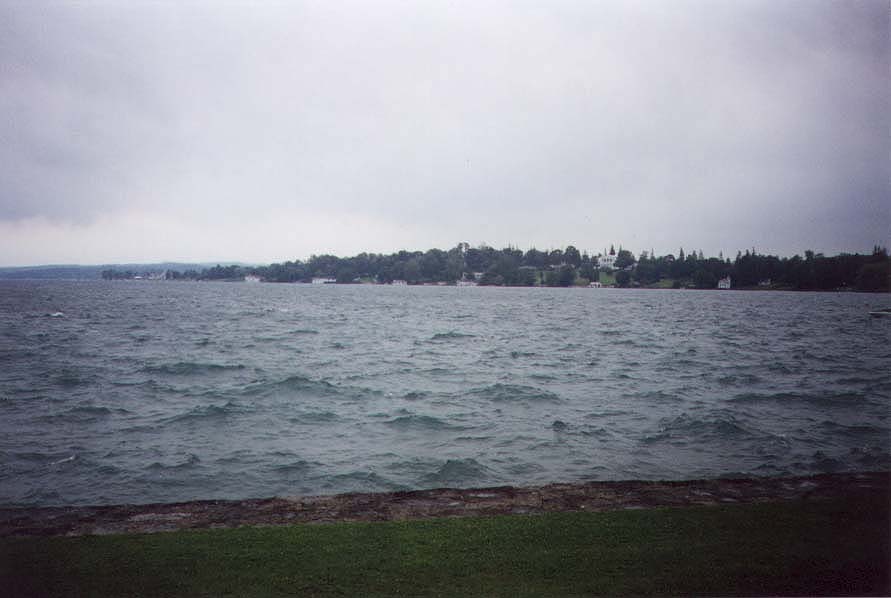
US 20 is the main street of Skaneateles. Note shields for the junction with NY 321. |
|
In the village, the highway offers views of Skaneateles Lake. |
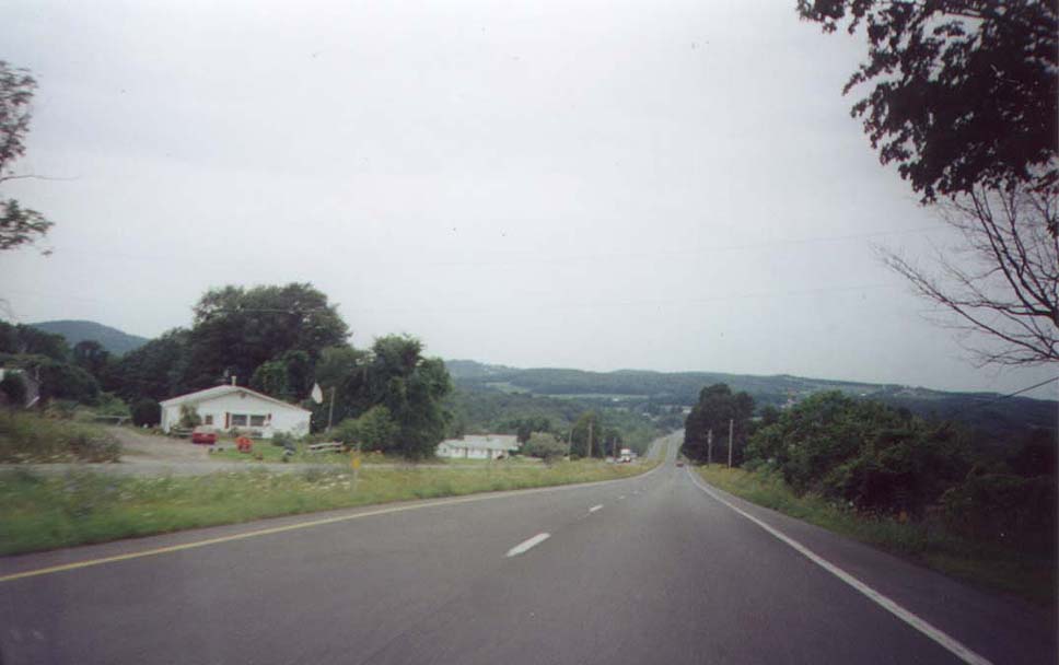
Entering Madison County by way of Cazenovia, the route flattens only relatively. It enters the true heart of New York State, not only geographically but also in spirit. The villages are small and often ramshackle; the landscape is overcultivated pasture and muckland. Both speak of a forgotten glory and individuality, no longer relevant in this age of the megalopolis.
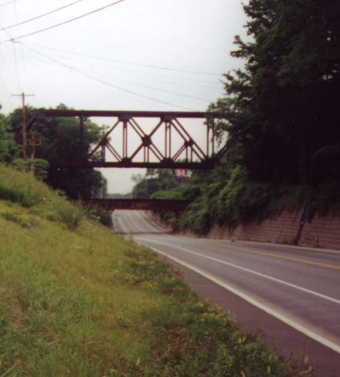
The way becomes even more desolate and hilly as we make the last long haul through the Cherry Valley, along the eponymous Turnpike, over the shoulder of the plateau and through the Schoharie Creek valley, into the outskirts of Albany. Railroad enthusiasts will note with interest the unusual two-level overpass at Fullers Station, where the railroad rises up, crosses over itself at the same time it crosses the highway, and descends again on the opposite side.
|
US 20 westbound as it descends into Cherry Valley. |
|
Between Cazenovia and Esperance, much of US 20 follows a dual carriageway. |
|
The unusual railroad overpass at Fullers. |
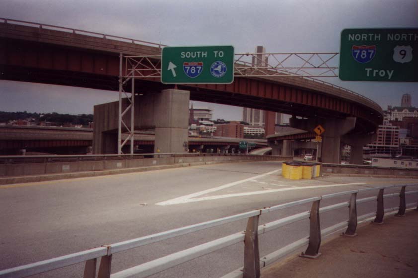
We pass the usual commercial strips, the State Office Campus, and the State University before making our stately entrance to the capital city along Madison Avenue. Ducking between the Empire State Plaza and the State Library and Museum, we hop onto the US 9/20 arterial and streak through an unusually complex and impressive interchange with I-787, onto the second-generation Dunn Memorial Bridge over the tidewater Hudson.

|
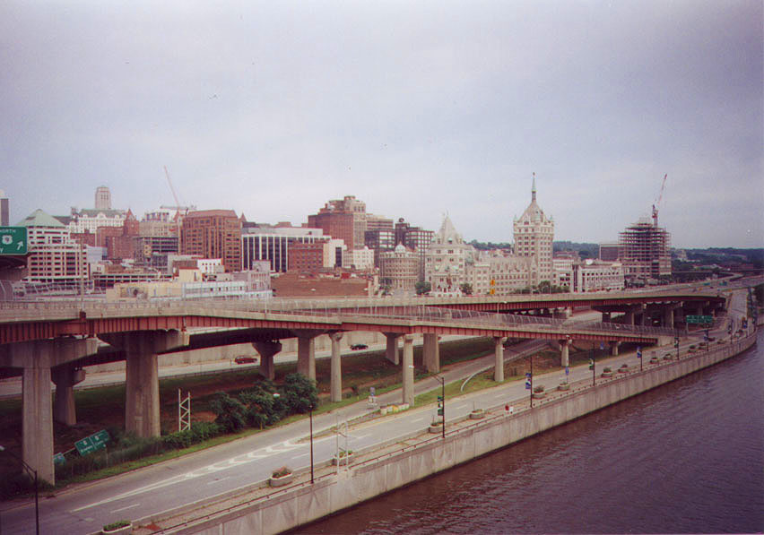
The Albany skyline from the east, approaching Rensselaer. US 20 here shares a roadway with US 9. |
|
The interchange with I-787. From below, a tangle of viaducts and overpasses, but from above, this interchange forms a perfect double circle. |
|
A view of Albany from the Dunn Memorial Bridge showing part of the interchange between I-787 and US 9. The ramp in the foreground is a bicycle and pedestrian structure, carrying NY Bike Routes 5 and 9. |
|
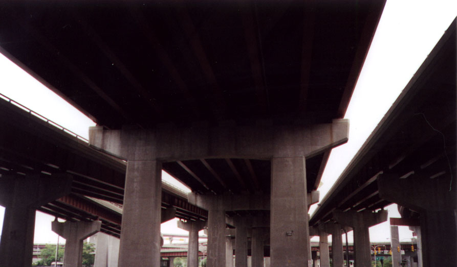
The underside of US 20. The center structure carries the South Mall Expressway; US 20 climbs up and down using the ramps on either side. The far left ramp connects I-787 with the Empire State Plaza. |
Dumped unceremoniously onto the streets of
Rensselaer, we have a long stretch of strip development left before we begin
to wind our way up the foothills of the Berkshires and through the Shaker
country of New Lebanon, and finally make our lofty passage along the side
of Mount Lebanon into Massachusetts, just west of Pittsfield. Another four
hours' driving should bring us to Kenmore Square, Boston, where US 20 ends quietly
in a noisy muddle of streets beneath a large, luminous triangle labeled "CITGO".
Quoted material taken from New York: A Guide to the
Empire State (American Guide Series), published 1940.
< Back