NY 97 Travelogue
(December 22, 1999)
(click any image to enlarge)
There was a lot of indecision as I drove the length of NY 97 three days before Christmas of 1999. Running through the Delaware River valley from Port Jervis to Hancock, the road could not decide whether to follow the river bank or ride high on the ridge above. It was unsure whether it ought to be arrow-straight or as twisting as any mountain highway. The homes along the way were torn between being warm, comfortable country houses or run-down, nearly abandoned tarpaper shacks. Even the railroad which parallels the highway cannot choose between the states of New York and Pennsylvania. And with the solstice sun fighting to stay alive between the high valley walls and through the pine woods, while the brightest full moon in seven score of years rose upon the opposite horizon, it was never quite clear whether my journey would be by night or by day.
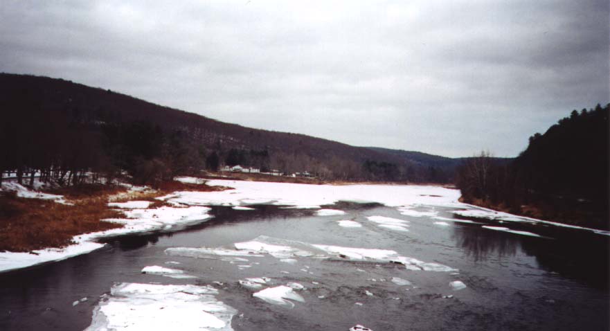 |
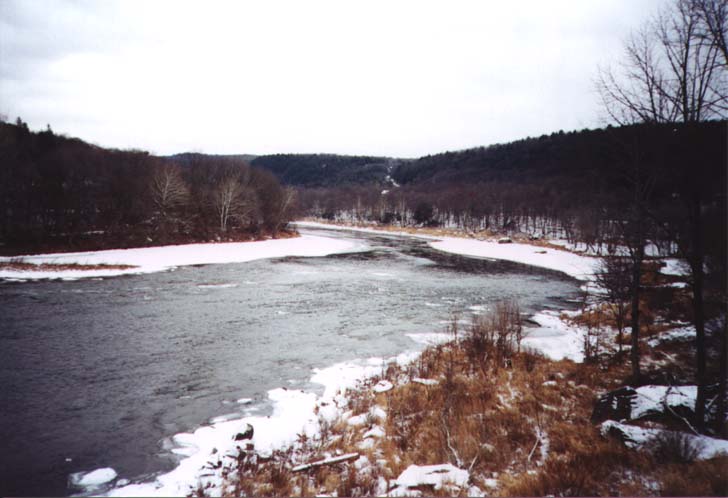
Throughout its length, NY 97 follows the Delaware River valley. The route boasts dozens of river views, like these taken from the Roebling Aqueduct bridge. |
 |
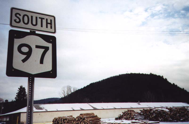
NY 97 begins in the city of Port Jervis, which lies on the Delaware River at the common boundary of New York, Pennsylvania and New Jersey. Port Jervis has a history so dependent on river, canal and railroad transportation (it was named for the chief engineer of the Delaware and Hudson Canal) that it should have fallen by the wayside years ago, but it is located just close enough to New York City that it is able to survive as an alluring frontier town for the most adventurous suburbanites. It also serves as a gateway for recreationists along the great River, which is reserved by the Federal government for fishing, canoeing, and other diversions. NY 97 begins in common with NY 42, at the intersection with US Routes 6 and 209, also running in common, as they head across the river to Matamoras, Pennsylvania.
At the far end of Sparrow Bush, a residential pseudopod of Port Jervis, NY 42 leaves us on its way up the Mongaup Valley toward Monticello. We who take the road less travelled are rewarded as we enter one of the most spectacular stretches of highway in the State. The road runs tightly between two vertical walls, but we feel no confinement. For the wall on our right rises straight up to the plateau, while the wall on our left drops straight down to the river. A grand vista opens before us of the river taking a majestic sweep around a promontory. A series of quick, tight curves is built into the roadway here, probably as much to slow the traffic as for dramatic effect. The experience is brief, however, and we soon follow the river around that bend to settle in for a more leisurely trip through the lonely valley.
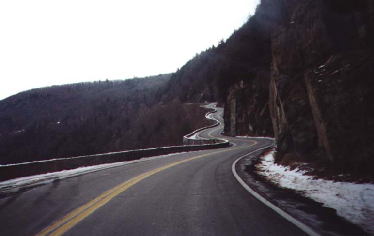 |
Between vertical stone walls at a place called Hawks Nest, NY 97 swings dramatically back and forth like an Alpine highway. |
Crossing the mouth of the Mongaup River, we enter Sullivan County, which occupies the greater part of our distance. Characteristic of this section of the road are curves hugging every bend in the river and settlements so small you wouldn't notice them, had the state DOT not graciously erected marker signs at their outskirts. These places seem all to be named for eddies: Knights Eddy, Pond Eddy, Handsome Eddy. They consist of little more than a supply shop for the outdoorsman, or perhaps a restaurant and lodge or a tavern. At certain places, bridges carry one-lane gravel or macadam roads across the state line to even smaller settlements in Pennsylvania. Many of these are virtually inaccessible from the interior of Pennsylvania itself, so gold-on-blue license plates are a common sight along NY 97.
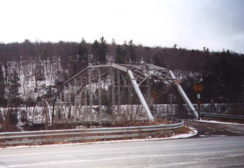 |
This wood-decked bridge leads to Pond Eddy, Pennsylvania, which is completely inaccessible by road from anywhere else in the Keystone State. |
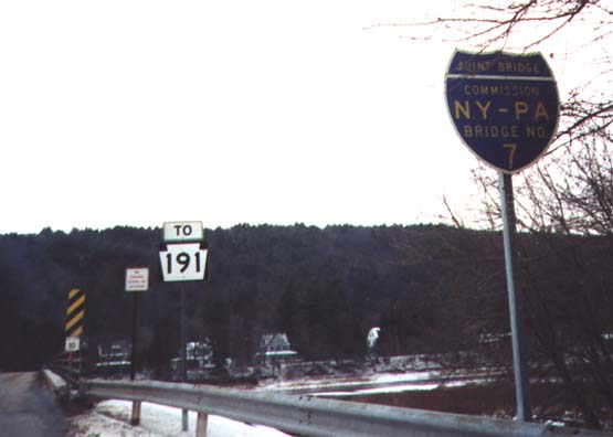 |
The Delaware River bridges between New York and Pennsylvania are the responsibility of a joint bridge commission. At this bridge in Callicoon, a sign in the shape of an Interstate shield identifies Bridge No. 7. |
Barryville, a tiny hamlet by statewide standards, is surprisingly large for this area. It contains several houses, general stores, and so forth, but nothing so substantial as a late-night restaurant or gas station. Just up the river is Minisink Ford, where a plaque explains the historical significance of the place (these markers are prolific throughout the route). Also at Minisink Ford is the Roebling Delaware Aqueduct National Historic Site. This consists merely of a structure spanning the river, originally an aqueduct, designed by the famous nineteenth-century civil engineer who later conceived the Brooklyn Bridge. It now carries another minor local road over to Lackawaxen, Pennsylvania.
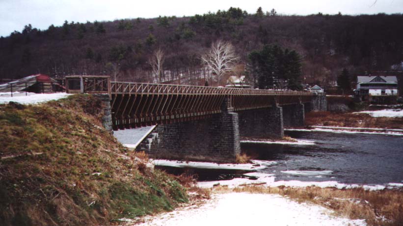 |
This is the Roebling Delaware Aqueduct, which carried the Delaware and Hudson Canal across the river. Today, the National Park Service maintains it as a recreational attraction. |
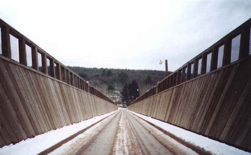 |
Auto and bike traffic follows what used to be the canal bottom, while pedestrians use reconstructed walkways on either side where towpaths would have been. |
The twilight lessened considerably on my trip as the road mounted the shoulder of the valley and pierced the forested hillside. In all the homes in the township called Tusten, a comforting light was burning and the smell from the chimney reminded me where I was headed, but the desolate surroundings, my growing hunger and my depleting fuel supply reminded me I had a great many miles ahead.
Descending again, not quite all the way down to the riverside, we pass towns of increasing size: Narrowsburg, Skinners Falls, Cochecton, Callicoon. All of these places are reached by side roads that drop abrubtly from the highway and wind tightly into the village. The one I visited was Callicoon. It, like the others, was a Christmas jewel of surprising grace and festivity. In this town so far removed from urban development that the existence of shopping malls and chain eateries is quite irrelevant, was a public square lined with a few stores, several bars, and the necessary civic structures: a steepled town hall or one-room library. Every building was decked with colorful lights and all the townspeople were out and about on this early winter evening. Down the center of the square, dividing it lengthwise, the railroad still runs and the station still stands; of course, the trains no longer stop here. At the outskirts, the local roads run down, around and under the highway as it bridges Callicoon Creek; up this valley toward the area of lakes and resorts runs NY 17B.
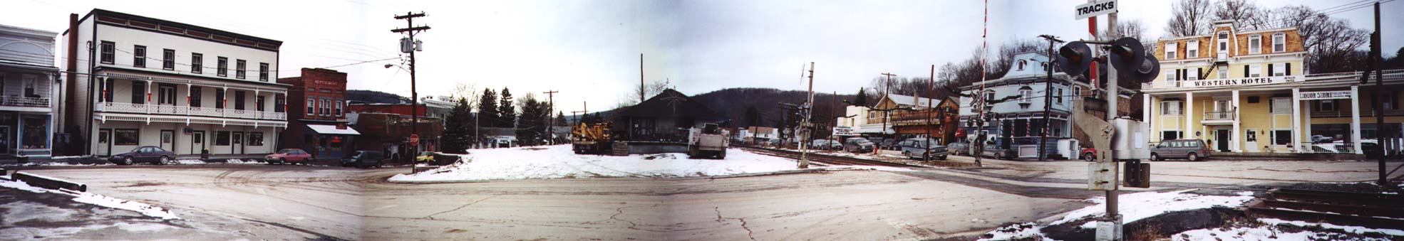 |
A panoramic view of the hamlet of Callicoon, showing a hotel, movie theater, tavern and railway station. |
The local road climbs back up and sidles back into NY 97, while others similarly branch to our right and climb the gullies to the hilltop farmlands. More riverside towns: Hankins, Long Eddy, and then we leave Sullivan County for Delaware, and the riverside for the forested interior. It's not long, though, before we rejoin the river, and we finally see the lights of Hancock around the next bend. Hancock is a village of less than fourteen hundred, but to this weary traveller, sorely in need of several kinds of relief, it seemed a metropolis. The village lies at odd angles to the Delaware River's east and west branches, which join here. The main street still has its storefronts and parks, the fire brigade was already busy for the evening, and the atmosphere was as festive as anywhere. It was to be my last stop before joining the fast track for home.
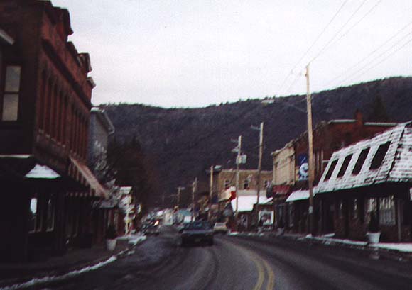 |
A street in Hancock, the festively-decorated final stop on our journey. |
NY 97 wanders toward the western edge of town, turns a corner and comes
to an end at the entrance to the NY 17 expressway some forty miles east
of Binghamton.
< Back