NY 17 Travelogue
(Original Routing)
(click any image to enlarge)
This venerable highway, the main thoroughfare of the Southern Tier, largely follows the route of the Erie Railroad, which, despite troubled beginnings, brought a means of economic growth to the Southern Tier and enabled it to reasonably compete with the northern areas fed by the Erie Canal. The long, slow task of pushing a railroad through four hundred miles of rugged terrain was mirrored by the building of the NY 17 expressway, and later by the movement, now brought partially to fruition, to provide an Interstate designation for this important corridor.
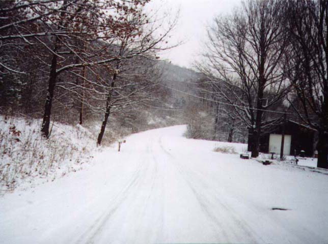 |
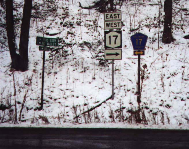
On a winter's day in its early years, NY 17 probably looked much like
this. This is one of three segments of the old highway near Lowman that are now Chemung CR 60. |
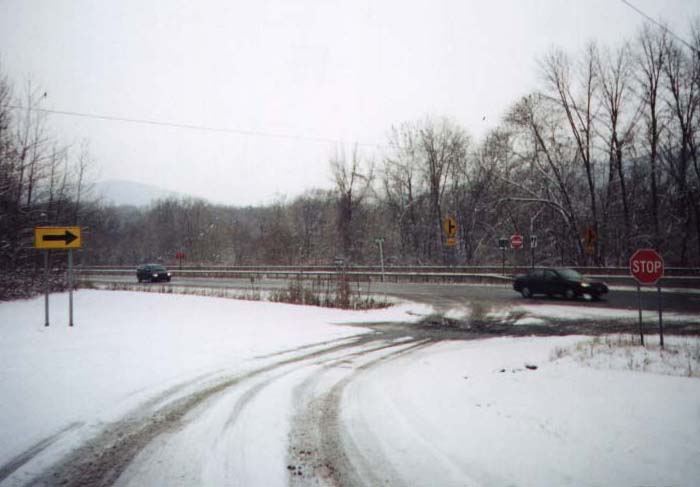 |
The old highway meets the new, at a dangerous intersection soon to be removed as part of the upgrade to Interstate 86. |
Our trip along the original path of State Highway 17 begins at Westfield, located in the Lake Erie grape belt and long the headquarters of Welch's Grape Juice Company. Heading southeast on today's NY 394, we mount the ridge that contains the basin of Lake Erie and enter Mayville, the modest seat of Chautauqua County and head point of Chautauqua Lake. This lake resembles the Finger Lakes, but because of its distance from them, it is not counted among their number. Continuing on NY 394 (formerly NY 17J, one of many lettered alternates to the main highway) would take us along the lake's southern shore and past the Chautauqua Institution, but we turn instead onto NY 430 to follow the northern route. All along the shore, dirt roads and private lanes lead to lakeside summer residences. In the village of Bemus Point is a ferry, originally an important link but now used more as a tourist diversion since the new expressway (which from here heads west towards Erie, Pennsylvania) brought a bridge across the narrows.
Hilly Jamestown, at the outlet of the lake, is the largest city in southwestern New York and was once an important center of furniture manufacturing. Rejoining NY 394 at this point, we head east through the valley of this river and that creek, weaving back and forth across railroad and Interstate. At the western end of the Allegany Indian Reservation, we are obliged to follow the expressway for some distance, as the old roadbed was taken over by the Allegheny Reservoir and is at times completely submerged. We follow the Allegheny River for many miles through the reservation and along the northern edge of Allegany State Park, the largest in New York. In Salamanca we leave the Interstate and rejoin our intended path, now designated NY 417. Salamanca is the only incorporated municipality in the State lying within an Indian reservation; the Seneca Nation has a strong presence here and did not passively submit to further displacement by such projects as the reservoir and the expressway.
We soon enter Olean, neighbor city to Salamanca and companion railroad junction point. New vitality is expected to befall these and other cities in the Southern Tier as a result of the Interstate 86 designation and the Norfolk Southern Railroad takeover of the obsolete giant, ConRail.
The expressway swings far to the north at this point, but the older road stays near the Pennsylvania border as we enter one of the last-populated areas of New York. This fact is understandable as we repeatedly labor over steep slopes to reach the next available valley, but the eventual settlement of the region is also understandable, as this is a once-profitable oil producing area. The opening of the western states, however, with their large expanses of open, accessible land, has drawn production away. This is well evidenced in Wellsville, where the fine old homes of oil tycoons have fallen into drab disrepair, and the busy market streets have become just another place to buy gasoline on one's way to someplace else.
Our climb over the slopes of the Allegheny Plateau, which stretches along the entire southern boundary of the State, brings us through small villages and even smaller hamlets, until we reach Painted Post, so named for just such an object that once stood here. The village lies at the confluence of the Cohocton and Tioga Rivers, which unite as the Chemung. Just down the river, pressed in between the hillsides, is the city of Corning, fortunate in that its primary industry, glassmaking, was not lost as in so many other similar cities. The Corning Glass Company manufactures and develops several highly specialized types of glass, used in products ranging from cookware to the world's largest reflecting telescope mirror. Its exhibition center remains a major attraction in the region.
The old highway east of Corning is today known as NY 352. It passes through the Soaring Capital of America, centered at Harris Field in the town of Big Flats. The name Big Flats refers to a broad area of fertile farmland, which our route follows, looping away from the valley of the Chemung. An alternate, the former NY 17E (today a continuation of NY 352), stays beside the river all the way into Elmira.
At Horseheads we turn south along NY 14. The unusual name of this town stems from an incident during Revolutionary days, when General Sullivan's men were forced to eat their own horses, leaving only the heads for scavengers. Continuing south through an industrial corridor, we come to Elmira, another neglected Southern Tier city and the largest other than Binghamton. Modest blue-collar homes and a few remaining neighborhood businesses are characteristic of the area, although our particular path leads us through a more affluent section of the city. Elmira is today best known for having been for many years the summer home of Mark Twain, who worked on some of his most famous books at the farm owned by his wife's family. All over the city and its environs are names such as the Mark Twain Motor Inn, Clemens Center Parkway and the annual Huck Finn River Raft Race.
 |
Another view of the old highway, this time on Broome CR 28 between Damascus and McClure. |
 |
One of many instances where the old road crosses the new expressway, allowing the traveller on Old NY 17 a taste of the grandeur of its replacement. |
The route east of Elmira has been largely taken over by the new expressway alignment; at Lowman we move off onto County Route 60. The valley narrows here as our path rejoins the Chemung River, which flows into the Susquehanna at Sayre, Pennsylvania. Skirting the Pennsylvania border very closely now, we pass through the village of Waverly, neighbor to Sayre and Athens across the state line and gateway to New York from north-central Pennsylvania. We are now on NY 17C, which runs along the Susquehanna River opposite the expressway.
Steep hills rise abruptly on either side as we approach Owego. This village, seat of Tioga County, is one of many along the way that began life as an Indian village that was burned by the Sullivan-Clinton campaign in 1779, whose trail this section of the route follows. Crossing the river now, we follow NY 434, closely parallelled by the expressway. Continuing along the north bank, the alternate NY 17C leads through the Endicott-Johnson villages (Endicott, Endwell and Johnson City), named for the two men who brought industry to the area with the manufacture of shoes.
NY 434 is a newer road than the original NY 17, which ran along the Old Vestal Road just to the north. Entering downtown Binghamton, the route recrosses the river. Binghamton achieved prosperity as a major railroad hub and canal terminal, which spurred the growth of an unusual number of industries, most notably shoes and associated products. The city sits between and among the hills at the confluence of the Susquehanna and Chenango Rivers. Although rail traffic has subsided and the Chenango Canal has long been abandoned, Binghamton remains an important highway junction, with two primary Interstates (soon to be three) and a number of local thoroughfares converging.
The valley now narrows and the hills close in. Now and again we are obliged to follow the expressway alignment: due to the proximity of the valley walls, the local road carrying a variety of county highway numbers has in some places been completely overrun by the newer road. Shortly after leaving Binghamton, we enter the most enchanting and loneliest part of the trip. The road now follows the diminishing Delaware River and a number of its tributaries into the foothills of the Catskill Mountains. Deposit and Hancock are the only particularly large settlements here; others such as Hale Eddy, Fishs Eddy and Peaksville are little more than rows of shacks and trailer homes, bristling with antennas and satellite receivers, along a railroad siding or riverbend. All through this section the old road hugs every turn in the river while the highway weaves back and forth, cutting corners across bends; at one point it actually runs directly above the local road on an elevated structure for some distance, an unusual feature in such a remote area.
 |
Two views of the viaduct that carries the NY 17 expressway directly above Delaware CR 17, like an urban elevated freeway displaced. |
 |
As we leave behind Delaware County for Sullivan, our surroundings become more congested (note that this term here is highly relative). We are now in the southern Catskills, just on the outskirts of Catskill Park. Not the scene of Washington Irving's colorful tales and characters, this is rather the resort area with its small, scattered lakes and extravagant chateaux. From early days Sullivan County has been known as a playground for wealthy New Yorkers, and its northern part is famed for its covered bridges.
The first sign of civilization for many miles appears at Parksville. Parksville takes advantage of its location at an isolated at-grade intersection, rather than an interchange, along the expressway by providing a number of much-needed services for the long-distance traveller. Just beyond is the village of Liberty, one of the two main resort centers of the county, which seems all the larger by virtue of the comparative emptiness now behind us. The next, more populous village is Monticello, county seat and trading center for tourists and locals alike.
The last stretch of our journey takes us through an area of thickening exurbia as we traverse the once-sparsely populated farmland of Orange County. Continuing east from Monticello, still following roads today maintained by Sullivan County, we sweep into Wurtsboro at the base of the Neversink Valley. The village is tightly hemmed in by the Allegheny Plateau on the west and the Shawangunk Mountains on the east. The land flattens considerably as we cross into Orange County and onto the broad shoulder of the Hudson Highlands. Shortly we join the modern NY 17M and follow it into Middletown. This city had its origin as a trading center for the wide-ranging farmland surrounding it. At Middletown, US 6 joins our route, but leaves it shortly thereafter for the expressway.
There now follows a succession of large villages. The first is Goshen, county seat and haven for light-harness horse racing. A close neighbor to Goshen is Chester, home to the famous trotting horse Hambletonian. Monroe and Harriman, the latter named for a wealthy landowner and benefactor of the huge park that bears his name, are next and mark the end of NY 17M.
For the last segment, our route occupies the last remaining stretch of Old NY 17 that still bears the original designation. After the completion of the I-86 designation early next century, this will be the last remaining piece of NY 17 altogether. It shares a narrow corridor with the New York State Thruway and the Norfolk Southern Railroad, skirting the western edge of the Ramapo Mountains and Harriman State Park, second only in size to Allegany and formerly the main New York State unit of the Palisades Interstate Park complex.
We pass an entrance to the village of Tuxedo Park, a community so exclusive that its residents were of sufficient social status to popularize the most fashionable piece of men's evening wear, which took the name of the village. Sloatsburg and Hillburn, villages of the Ramapo River, are the last two points on our trip of over four hundred miles. We cross the New Jersey state line at the junction with Interstate 287 in Hillburn.
 |
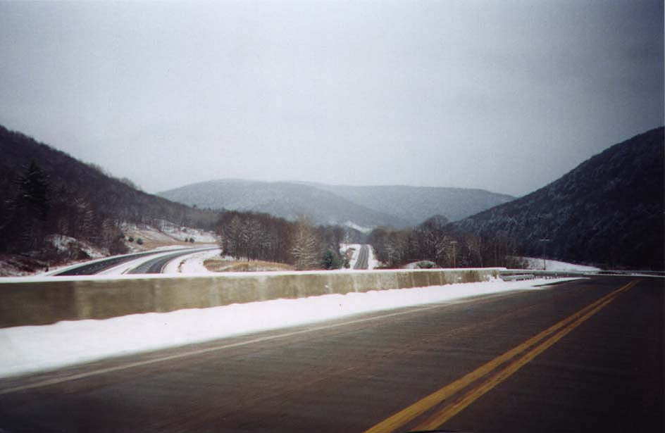
Through Broome and Delaware Counties, the NY 17 expressway offers views to rival the most spectacular in the State. This is near Hale Eddy, between Deposit and Hancock. |
 |
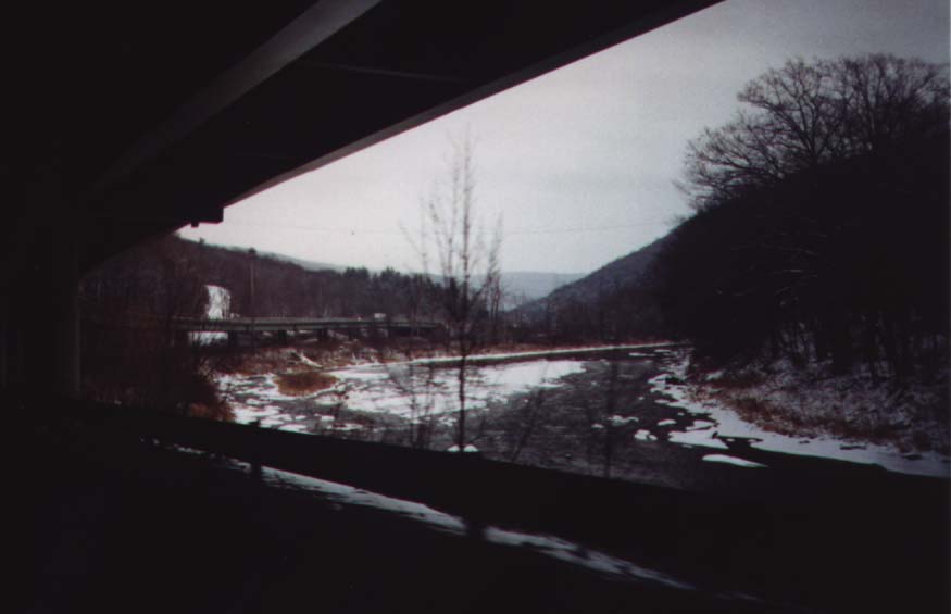
Another fine vista, at Exit 90 in East Branch. Here, NY 17 intersects
Delaware CR 17 and NY 30. |
The trek now behind us has taken us through some of the most depressed
areas of rural and urban New York, as well as some of the most affluent.
We have witnessed historical events both sordid and delightful, both antique
and ongoing. We have seen the effects of the rise and fall of industry
and commerce, and we are left to hope that the cycle is once again in its
waxing phase. Perhaps the only constant has been our experience of the
beauty of New York State at its finest.
< Back