Interchange of the Week
Monday, 6 August 2001
Monday, 6 August 2001
I-81 & I-88, Port Dickinson
NY 7
|
| A full-size
image (476 kb) is also available. |
|
|
| A full-size
image (476 kb) is also available. |
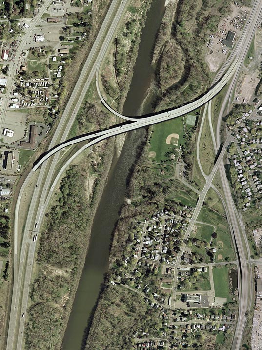
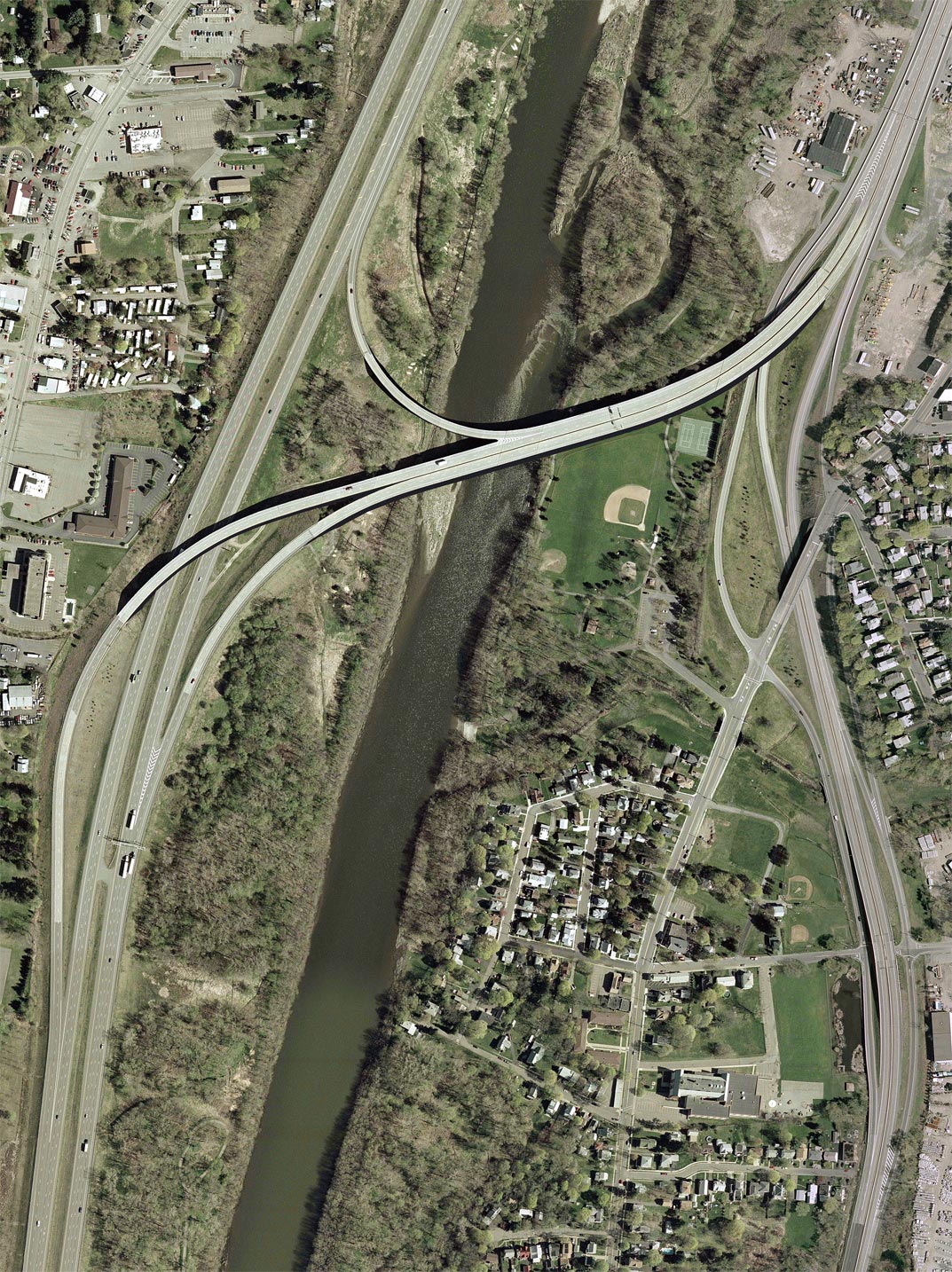
Orientation: Interstate 81 runs bottom to top at left, alongside the Chenango River. Interstate 88 branches off at center, toward top right. NY 7 runs from bottom to top along the divided highway at right, joining with I-88 at top right.
Chenango Street, formerly NY 7, runs along the east side of the Chenango River. South of current NY 7, it now carries reference route 990H. Phelps Street runs east from Chenango Street, crossing under NY 7. US 11 is visible at top left.
Exit numbers: Exit 1 from Interstate 88 westbound is for NY 7 west (geographically south) to Binghamton. From I-81, the exit to I-88 is not numbered.
The interchange: The last section of Interstate 88 to be completed was its connection to I-81 across the Chenango River. This connector is mostly elevated, passing above westbound NY 7 and its service road, a local park, and the river itself. The ramp to I-81 northbound actually branches off of the bridge over the Chenango. Missing from the interchange is a ramp from I-81 southbound to I-88; the connection can be made to the south via I-81/NY 17 to NY 7 east (north), or to the north via US 11, NY 12 and NY 12A. (It can also be made by reversing direction on I-81 at Exit 5 [US 11].)
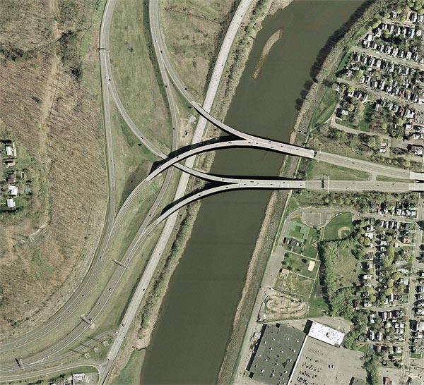
In this photo can be seen the southern end of the service roads
running along either side of NY 7 and I-88. They begin at a
half-diamond interchange between NY 7 and Phelps Street, from which
there is also a northbound entrance. Although there appears from the
photo to be another half-diamond between I-88/NY
7 and Chenango Street, there are in fact no other ramps to or from the
service
roads. The next northward interchange is Exit 2 (NY 12A), which
essentially
provides the only connection between Chenango Street and points
northeast.
 |
| A full-size
image (320 kb) is also available. |
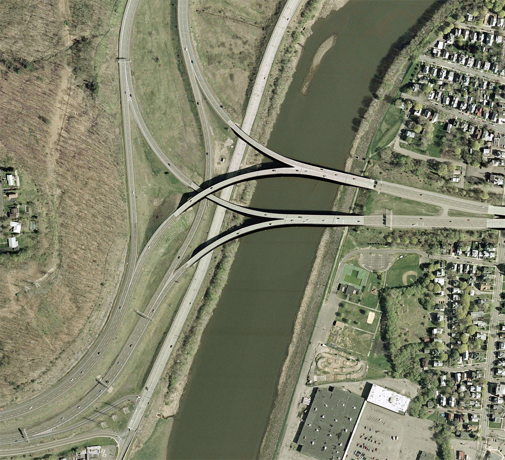
Orientation: I-81 enters at right and exits at top, while NY 17 enters at bottom left. I-81 and NY 17 overlap for several miles east of this point. US 11 runs immediately alongside the Chenango River. Chenango Street is just visible at right.
Exit numbers: Exit 72 from NY 17 eastbound is for US 11 (Front Street). Exit 72 westbound, not shown, is for Mygatt Street. The junction of I-81 and NY 17 is not numbered, because it is the split of two overlapping routes and therefore not strictly an exit.
The interchange: Here again is an example, more dramatic than the above, of an interchange elevated partially above the Chenango River (and US 11). In other respects the interchange is a quite normal directional-T form, with a three-level crossover. Also visible at bottom left is the so-called "Kamikaze Curve", where NY 17 makes a sharp bend around the hillside. The radius of this curve is below Interstate standards, and must be rectified before the Interstate 86 designation can be extended to this part of NY 17.
The black bands visible along elevated structures in these photos is
from
digital adjustments made to the imagery to correct orthographic
distortion.
<< Back