Interchange of the Week
Monday, 11 June 2001
Monday, 11 June 2001
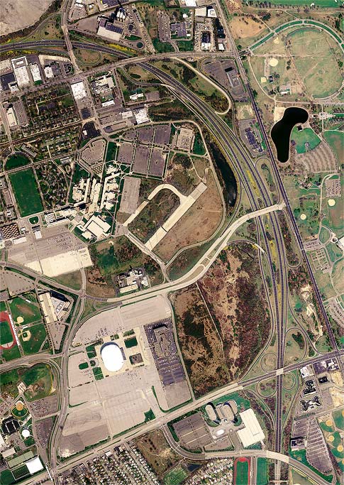
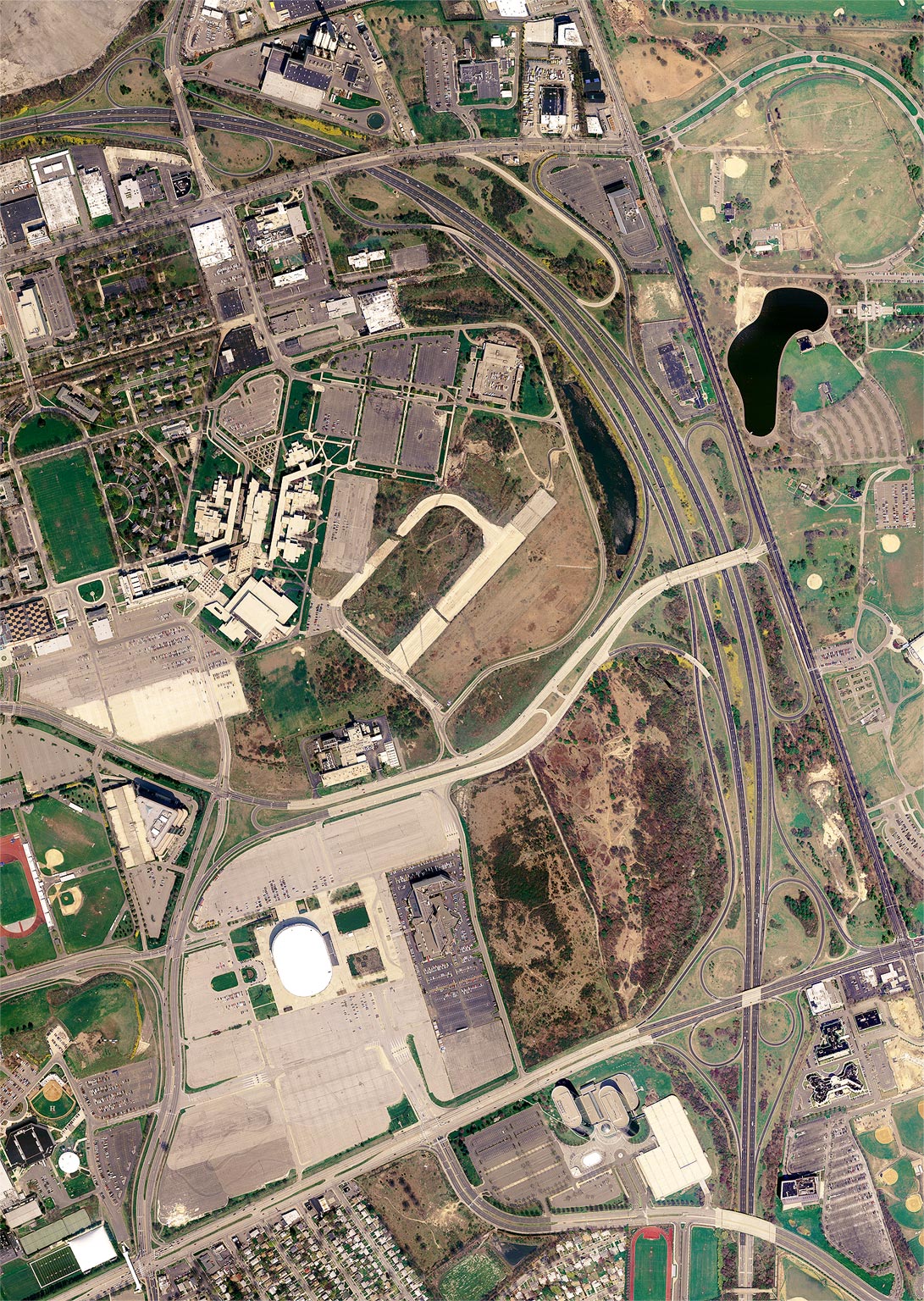
NY 24 & Meadowbrook Parkway, Uniondale
Mitchel Field
 |
|
|
|
|
|
|
Orientation: The Meadowbrook Parkway runs from top left to
bottom right.
NY 24 runs along the Hempstead Turnpike from left to right at bottom.
Charles Lindbergh Boulevard runs from the Meadowbrook Parkway at
center, towards the Mitchel Field area at left. East Stewart Avenue is
the east-west surface road at top, and it is intersected by Merchants
Concourse. Merrick Avenue runs parallel to the Meadowbrook Parkway
along the right edge of the photo (the stretch visible here, bordering
Eisenhower Park, is officially named Korean War Veterans Memorial
Drive).
The Mitchel Field area, a former military aviation installment, comprises Nassau Community College (top left), the Nassau Veterans Memorial Coliseum (bottom left) and Mitchel Park. A fragment of an old airfield runway is clearly visible in this photo on the grounds of the college.
Exit numbers: Ext M3E in both directions on the Meadowbrook Parwkay is for Merchants Concourse, and Exit M3W is for East Stewart Avenue. Exit M4 is for NY 24 westbound to Hempstead, and also includes Charles Lindbergh Boulevard and a northbound-only ramp to Merrick Avenue (via East Stewart Avenue). Exit M5 is for NY 24 eastbound to East Meadow.
The interchange: Several discrete interchanges overlap in this complex, as is typical of highways all over Long Island where closely-spaced interchanges are commonplace. It is not unusual for a full or partial cloverleaf to overlap an adjacent interchange, or for a cloverleaf to be interrupted and extruded to accomodate two or more roadways. The interchange series depicted above is one example of this.
The interchange between the Meadowbrook Parkway and NY 24 is a full cloverleaf, half of which overlaps collector/distributor roads serving the Charles Lindbergh Boulevard interchange. This latter is a kind of half-cloverleaf (also similar to the "trumpet" design) providing access to and from the west only. The loop ramps of this interchange are highly compressed due to the proximity of the Meadowbrook Parkway to Merrick Avenue. Note also that the right turn channel from Charles Lindbergh Boulevard to Merrick Avenue takes the form of a slip ramp branching from the parkway loop ramp.
At the north end of the collector-distributor system, there are
entrances and a northbound exit for East Stewart Avenue. These are more
properly components of the parkway's next northward interchange, Exits
M3E and M3W. Note that the southbound entrance ramp here, as well as
that from Charles Lindbergh Boulevard, do not intersect the southbound
collector/distributor road, but rather fly over it to merge directly
with the Meadowbrook Parkway mainline. This is done to avoid close
spacing between ramps intersecting the collector/distributor road.