Interchange of the Week
Monday, 8 January 2000
Monday, 8 January 2000
I-190 & Peace Bridge, Buffalo
Overview
Click certain areas to view the detail page
|
|
A full-size
image (448 kb) is also available.
|
|
|
|
A full-size
image (448 kb) is also available.
|
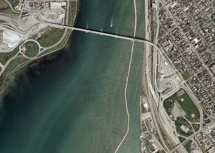
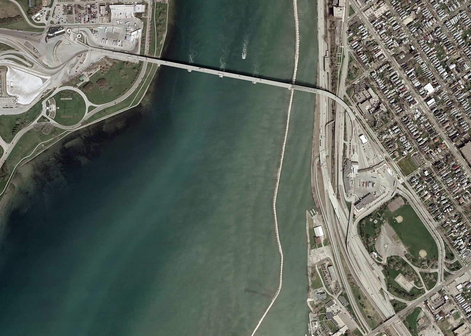
Orientation: The Peace Bridge spans the Niagara River at its head, where it is fed by the waters of Lake Erie. It connects the City of Buffalo, New York (right) with Fort Erie, Ontario, Canada (left), and is under the jurisdiction of the Buffalo and Fort Erie Public Bridge Authority. It also carries the NYSDOT reference route designation 955A. The Candian customs plaza is seen at top left, beyond which the road becomes the Queen Elizabeth Way, a freeway connecting the Niagara region of Ontario with Toronto. At bottom right is Front Park in Buffalo, adjacent to the United States customs plaza, which also serves as the westbound toll plaza for the bridge.
Along the riverfront in Buffalo runs Interstate 190, which follows the Niagara Section of the New York State Thruway. Niagara Street (NY 266) is the wide street running diagonally across the upper right corner; at extreme top, it is met by Busti Avenue. The latter runs two blocks south to a connector with I-190, then turns to run parallel to Niagara Street, alongside the customs plaza and Front Park. Porter Avenue is the street at bottom right, bordering Front Park to the south.
Niagara Boulevard is the riverside road in Fort Erie, continuing beyond Mather Circle (left) as Lakeshore Road.
Exit numbers: Exit N9 on the New York State Thruway
northbound
is for the Peace Bridge and Busti Avenue. Southbound it is signed for
the
Peace Bridge and Porter Avenue.
Buffalo connections
A separate page deals with the interchange between the Peace Bridge,
I-190 and Porter and Busti Avenues in Buffalo.
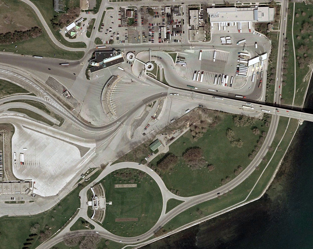
This closeup shows the Canadian customs plaza, with its typical
semicircular battery of inspection booths for autos. To the right of
this is the turnoff for trucks and buses. Past the inspection area, the
Queen Elizabeth Way begins, met immediately by an entrance from
Gooderich Street. In the eastbound direction (left to right), streams
of traffic from the QEW and from Niagara Region Route 3 merge together
as they swing around the customs plaza. To
the south of the plaza is the aptly-named Customs Park.