Editor's note: A curiosity of the roads of the Empire State is that they have a tendency to lead directly to the roads of the Keystone State. By this flawless argument, I have convinced myself that it is not inappropriate to include a gallery of Pennsylvania photos on a website devoted to the roads of New York.
|
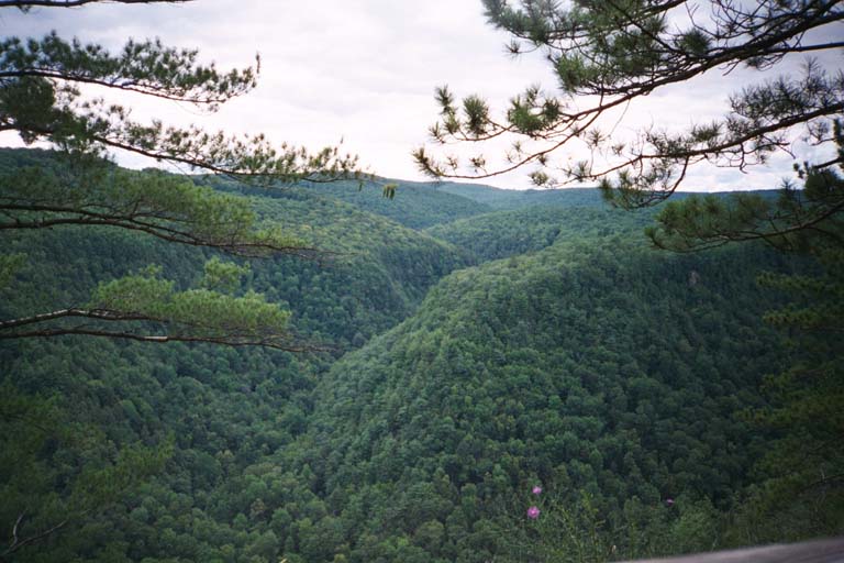
| The Pine Creek Gorge is heavily advertised as the Grand Canyon of Pennsylvania. This, the eastern view from Leonard Harrison State Park at the end of PA 660, west of Wellsboro, is attractive enough, but does not do the gorge justice with respect to the intense buildup it receives. |
|
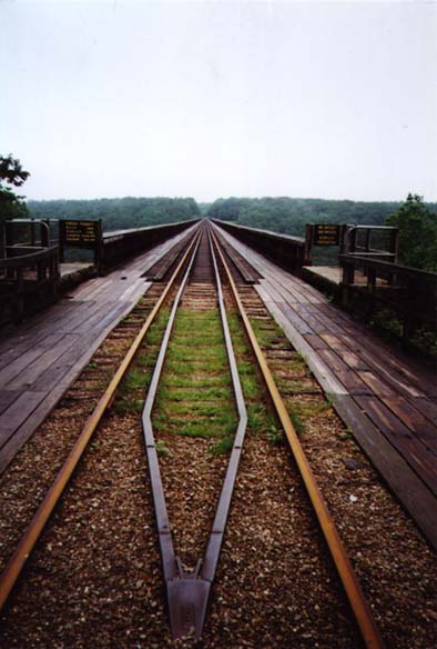
| The Kinzua Viaduct is far more impressive. It is 2,100 feet long and rises 301 feet above the valley floor, according to the plaque at left. Excursion trains cross the bridge twice daily, in season. When that's not happening, daring pedestrian traffic is permitted on the bridge. Two types of persons should not venture onto this bridge: those afraid of heights, and those with less than total confidence in the strength of the planks that carry the walkway along either side of the bridge structure. This view is from the eastern end, at Kinzua Bridge State Park near Mount Jewett. |
|
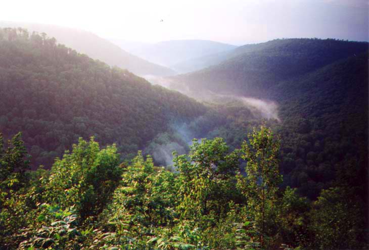
| The Loyalsock Canyon Vista is in Wyoming State Forest near Forksville. This view of the Endless Mountains is more open, more intimate, and more impressive than the Pine Creek Gorge viewpoint above. |
|
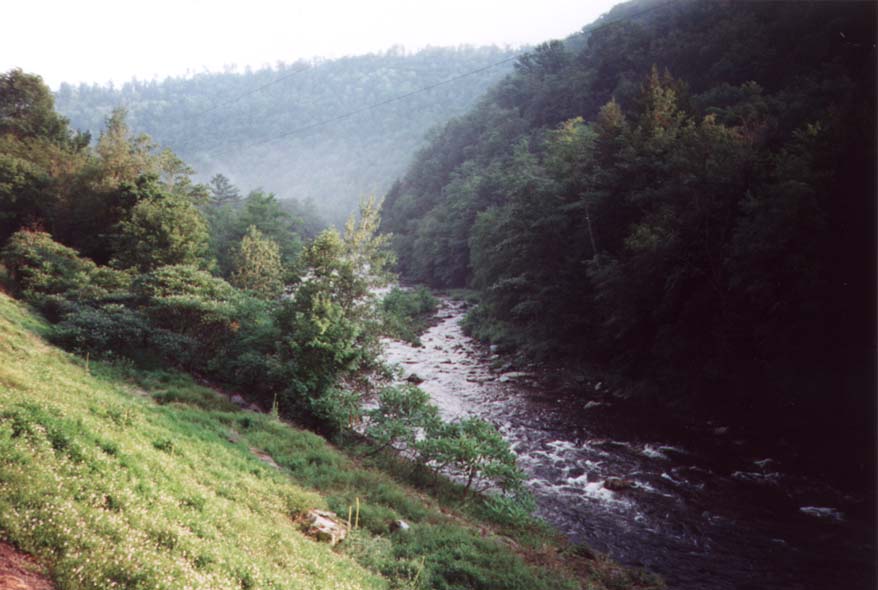
| At the bottom of the canyon, sprightly Loyalsock Creek runs through World's End State Park. This delightful scene is right on PA 154, southeast of Forksville. |
|
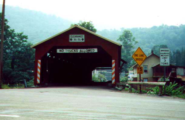
| An old covered bridge spans Loyalsock Creek in the Borough of Forksville. Besides the intrinsic interest of the bridge itself, it also displays a comprehensive collection of bridge-related signage. |
|
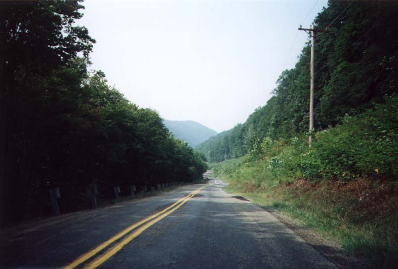
| This is a stretch of PA 144 near Oleona. It looks like a fun drive (even more so in person than in this photo), and so it is. |
|
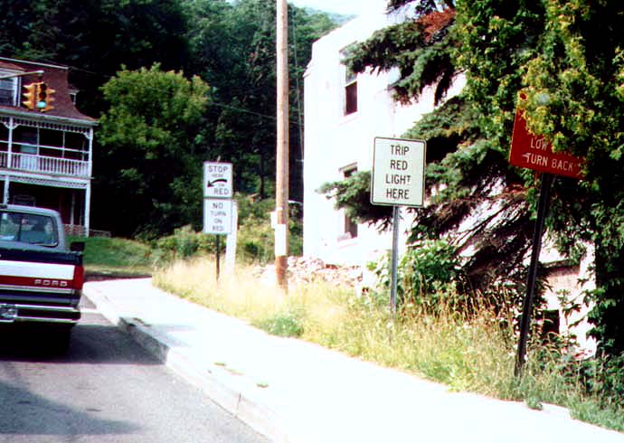
| Another comprehensive collection of themed signage, on PA 144 at US 6 in Galeton. This time, the signs all relate to the red phase of the traffic signal loacted here. The "Trip red light here" sign I haven't seen used aywhere else, and I'm not sure what its purpose is. Also note the red sign at far right: it is ominous enough from what is visible, but is even more mysterious for being obscured by the boughs of a tree. |
|
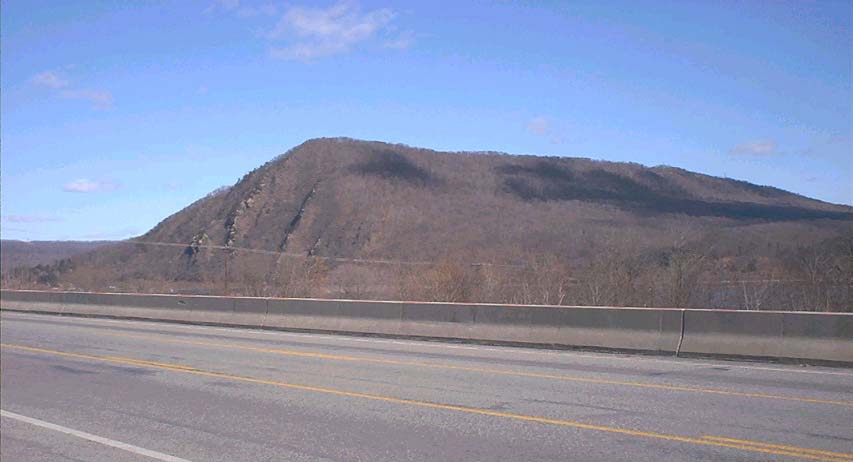
| The Susquehanna River cuts across central Pennsylvania's distinctive range of mountains, providing an important transportation corridor through an otherwise inaccessible region. Where the river has carved its path, the older mountain ridges are cleaved in two. This one is Second Mountain, probably so named for being the second such mountain upriver from Harrisburg (Blue Mountain being the first). The view is taken from Marysville, along US 11/US 15, which follow the river throughout this area. |
|
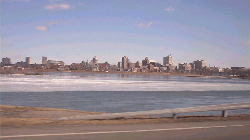
| Harrisburg, Pennsylvania's capital city, as viewed from across the Susquehanna River. This photo was taken along US 11/US 15 in the Borough of Wormleysburg. Besides the Capitol itself, several other government buildings are visible, such as the State Museum (round building at left) and the Archives Building just behind it. To the right of the Capitol are a cluster of state and federal office buildings and, beyond those, city and county government buildings. At far left, the M. Harvey Taylor Bridge is just visible. Although the sky is clear and bright, a sheet of ice upon the river betrays the chill February air. |
|
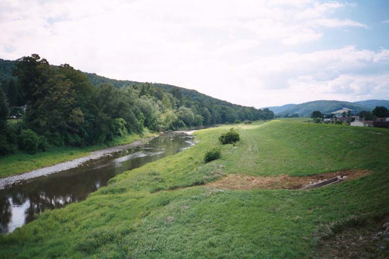
| The Cowanesque River traverses the Borough of Elkland, which borders New York's Steuben County. Here, a levee has been built between the river and adjoining properties. |
|
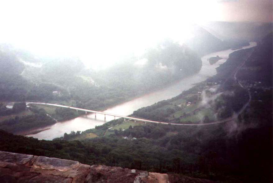
| Hyner View State Park offers this incredible panorama of the Susquehanna River where it is bridged by PA 120. On this day, a thunderstorm was brewing, so I only lingered long enough to snap this photo and hurry back down the mountain. |
< Gallery 1 | Gallery
3 >
< < Back